
Rehoboth Beach Officials Monitoring Significant Coastal Storm
September 22, 2026/
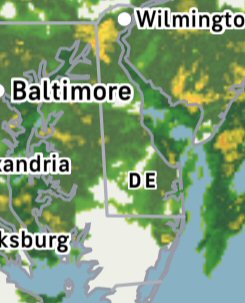 National Weather Service Expecting Coastal and Marine Hazards This Week; Storm Could Impact Rehoboth Beach
The City of Rehoboth Beach is monitoring a significant coastal storm that is expected to impact our area this week.
According to the National Weather Service (as of Tuesday, 9/22 at 7:00am):
- Coastal Flood Advisories are in effect for the Tuesday afternoon/evening high tide cycle for portions of our Atlantic coastal zones and the Delaware Bay.
- Coastal Flood Watches in effect Wednesday afternoon through Thursday evening for portions of our Atlantic coastal zones and the Delaware Bay.
- High rip current risk and dangerous surf expected through the week for all coastal areas.
- Gale Warning in Effect for all coastal waters Tuesday evening through Thursday.
- Wind Advisory issued for Atlantic coastal Delaware for Wednesday.
Key safety reminders for residents, visitors and businesses:
- High winds can lead to heavy surf conditions, so all water activities are prohibited. Be advised that there are no lifeguards on duty.
- Avoid the beach, as beach erosion can be caused by high surf.
- Motorists should use caution when driving and avoid any flooded roadways.
- In anticipation of high winds, secure all loose umbrellas, outdoor furniture, and trash cans. Please ask a neighbor to pull your trash can up from the curb if you are not home.
The City of Rehoboth Beach has crews ready to assist with any cleanup and preparation that is needed. We will keep you updated as conditions change.
For the latest forecast please visit www.weather.gov/phi
For more details on the timing and locations of the hazards mentioned above, please see the graphical hazardous weather outlook at https://www.weather.gov/erh/ghwo?wfo=phi