Posts Tagged ‘national weather service’
UPDATE: National Weather Service Confirms 2 EF-1 Tornadoes in Ridgely & Frederica
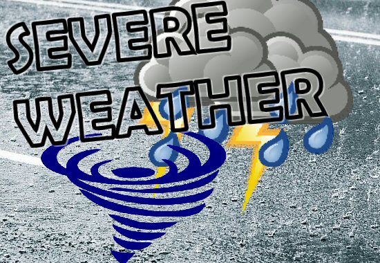
UPDATED – 03/18/26 – .Ridgely Maryland Thunderstorm Wind… Peak Wind /E/: 80-90 mph Path Length /statute/: 0.22 miles Path Width /maximum/: 75 yards Fatalities: 0 Injuries: 0 Start Date: March 16, 2026 Start Time: 10:24 PM EDT Start Location: 2.4 miles SSW Ridgely / Caroline County / MD Start Lat/Lon: 38.9147 / -75.9027 End Date:…
Read MoreNational Weather Service has Confirmed the Blizzard for Sussex County on Feb 23
The National Weather Service has now confirmed the blizzard that we experienced in the early morning hours of February 23rd in inland and coastal Sussex County and southern New Jersey. Blizzard criteria are met when sustained winds or frequent gusts of 35 mph accompanied by falling and/or blowing snow frequently reduce visibility to less than…
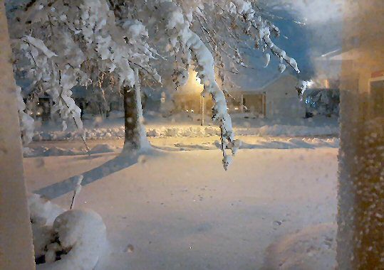
Read MoreSnow Covers Delaware

Snowfall totals keep adding up – with Dagsboro the big winner according to the DEOS Snow Monitoring Network at UD. The DEOS Monitor shows Dagsboro with 15.2-inches of snow followed by Harrington with 14-inches and Georgetown/Stockley at 12-inches. The National Weather Service at Mount Holly has different methods of monitoring snow totals – and Bethel…
Read MoreMore Snow This Season in Northern Delmarva

It’s been a snowier than usual winter for some parts of the country. According to the National Weather Service – Mount Washington in New Hampshire has topped it’s normal snowfall of 163” through February 12 – and has recorded 173.6” this year through Thursday! Closer to home Wilmington, Delaware has recorded 15.7” this year compared…
Read MoreUPDATE: State of Emergency Terminated in Delaware/Driving Restrictions Lifted Statewide

UPDATED 01/27/26 11:15 AM: Delaware Governor Meyer has lifted the remaining Level 1 Driving Warning in Kent and New Castle Counties, effective at 11:00 a.m. There are no driving warnings or restrictions in Delaware at this time. The cold weather advisory remains in effect as temperatures and wind chill will remain well below freezing in…
Read MoreWINTER STORM: Snowfall on Delmarva

Bear, Delaware was the big winner in Sunday’s Winter Storm Fern updated snow fall totals according to the National Weather Service posted at 2am Monday with 10-inches of snow – followed by Wilmington with 9-inches. In Sussex County Milton and Selbyville show with about 4-inches. Delaware’s heavier snowfall was in Kent and New Castle Counties.…
Read MoreUPDATED: National Weather Service Confirms EF-0 Tornado East of Frankford

UPDATED INFORMATION – 07/02/25 – Public Information Statement National Weather Service Mount Holly NJ 1224 PM EDT Wed Jul 2 2025 …NWS Damage Survey for Sussex County DE Tornado Update #1… .Update…EF-0 Tornado Confirmed in Frankford, DE on June 30th .Frankford Tornado… Rating: EF-0 Estimated Peak Wind: 65 mph Path Length /statute/: 0.5 miles Path…
Read MoreSaturday’s Storms Bring Hail & Winds to Delmarva

After storms moved through Delmarva Friday night, we saw more heavy weather – with thunderstorms Saturday afternoon. Some of those storms were accompanied by hail that was described as pea to dime-size in many places from New Castle County in Delaware to Somerset County in Maryland. The National Weather Service in Mount Holly, NJ and…
Read MoreUPDATED: National Weather Service Confirms an EF-1 Tornado Occurred Friday Night between Dorchester County & Bethel, DE

UPDATED – 05/18/25 – 5pm – The National Weather Service has confirmed that an E-F 1 tornado that began in eastern Dorchester County before crossing into Sussex County. Officials say the tornado formed at 6:52 Friday evening two miles south southeast of Rhodesdale, Maryland and ended at 7:06pm one mile south of Bethel. Estimated peak winds…
Read MoreNearly a Foot of Snow for Parts of Sussex County!

Sussex County was the winner for snowfall in Monday’s storm – with some areas receiving 7 to over 11-inches. DelDOT plows remain on the job working to clear Delaware’s roads and will continue to work into the early morning hours. New Castle County saw just a few inches of snow and DelDOT officials plan to…
Read MoreWinter Weather Awareness Week

This is winter weather awareness week in Delaware and state, county and local officials want you to be prepared and stay safe during cold weather, snow, ice and other emergencies. Each day this week the National Weather Service will focus on a different aspect of winter weather awareness – winter preparedness, heavy snow, ice, extreme cold,…
Read MoreMorning Storm Leaves Damage in Ocean City

It’s been a bumpy start to the Memorial Day weekend in Ocean City. A storm just after 9am has left behind damage to an area of Ocean City – and Bishopville. The National Weather Service (NWS) in Wakefield, VA has received numerous reports of damage from the thunderstorms that moved through Bishopville and Ocean City…
Read MoreUD Recognized as Storm Ready by National Weather Service
The University of Delaware has become the first university in the state to gain full Storm Ready status from the National Weather Service. The University is also one of only five other entities in the state to achieve such recognition. The University has met a series of standards to become Storm Ready: “Weather safety is…
Read MoreBridgeville/Greenwood Hit Saturday by EF 3 Tornado

The National Weather Service has issued it’s assessment on the tornado that rated EF 3 on the Enhanced Fujita Scale – that’s a “strong” tornado – with 136 to 165mph winds. Assessment from the National Weather Service on the Bridgeville-Ellendale Tornado… Rating: EF-3Estimated Peak Wind: 140 mphPath Length /statute/: 14.3 milesPath Width /maximum/: 700 yards…
Read MoreUPDATED: NWS Confirms Tornado in Bridgeville, Greenwood & Ellendale Areas; One Person Found Dead
UPDATED – 04/03/23 – 10:40am – The National Weather Service has confirmed a tornado in the Bridgeville area during Saturday’s storm. The tornado occurred around 6pm causing damage in the Bridgeville, Greenwood and Ellendale areas and leaving one person dead in a collapsed home on Tuckers Road near Greenwood. The National Weather Service is still…
Read MoreElevated Risk of Fire Spread in Delaware and Maryland Eastern Shore

The National Weather Service in Mount Holly, New Jersey is issuing a warning about an elevated risk for fire spread this afternoon across much of Delaware and the eastern shore of Maryland. A combination of low relative humidity, a strong northwest wind, and relatively dry fine fuels will contribute to the increased risk. The northwest…
Read MoreAs Atlantic Hurricane Season Begins, Marylanders Are Reminded: “Know Your Zone”

June 1st marks the beginning of the 2022 Atlantic Hurricane Season. The Maryland Department of Emergency Management reminds Marylanders as well as visitors to be aware of evacuation routes and to have an emergency plan and kit available. “Hurricane Ida taught us yet again that you don’t need to live in a coastal community to…
Read MoreTropical Weather Moves In On Delmarva Wed.
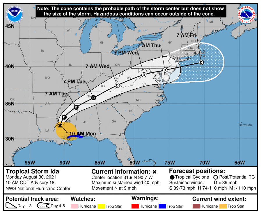
The effects of Ida, now a tropical depression, may be felt across our region starting late Wednesday. According to AccuWeather, skies will be mostly cloudy Wednesday, and a shower or thunderstorm may develop especially in the afternoon. Wednesday night, showers and a thunderstorm associated with Ida could lead to flooding. There also could be a…
Read MoreNWS To Investigate Inlet Funnel Cloud
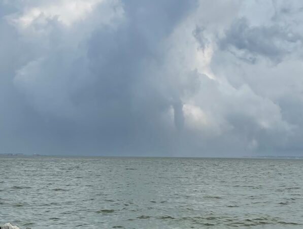
The National Weather Service said Friday that it will investigate the funnel cloud / waterspout at Indian River Inlet that was widely photographed and captured on video Thursday. Sussex County was under a tornado warning at the time. Inland circulating walls of wind were also reported. The storm also generated hail in some places. Damage…
Read MoreRip Current Risk Is High At Area Beaches

Summerlike temperatures, rip currents and no lifeguards on duty pre-season added up to a risky combination at Maryland and Delaware beaches. Ocean City Police Sunday pleaded with visitors and locals to stay out of the water. The Fire Department said there were several rescues from the ocean. One swimmer in distress at 5th Street was…
Read MoreElevated Wildfire Risk Today, Says NWS

A wide portion of Delmarva is under an enhanced risk of wildfire spread early this week, according to the National Weather Service. Winds today (Monday) may gust up to 30 miles-per-hour. Humidity is also expected to be low. People are urged to use caution handling any potential ignition sources including machinery, cigarettes and matches. Any…
Read MoreNWS Confirms Tornado Landed In Caroline Co. Monday

The National Weather Service has confirmed that a tornado touched down in Caroline County Monday. According to the Weather Service, it was an EF-0 tornado that landed near Henderson, Maryland along Maryland Route 313 at 3:13 p.m. Peak winds were estimated at 85 miles per hour. The tornado traveled about 5.3-miles, and was about 75…
Read MoreNational Weather Service Details Aug. 4th Tornado In Milford
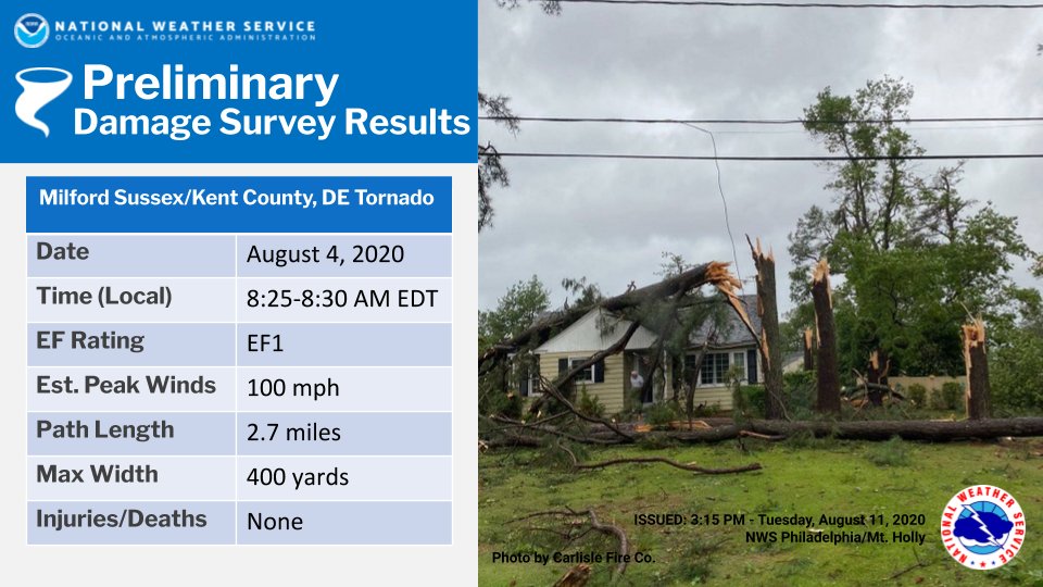
The National Weather Service documents another tornado in Delaware associated with Tropical Storm Isaias on August 4th. In a preliminary damage survey, the Weather Service says the tornado touched down at about 8:25 that morning in Milford, reached a peak wind of 100 miles per hour, and traveled 2.7 miles. It was 400 yards wide.…
Read MoreUpdate: 29-Mile Tornado Tore Through Del. Tuesday
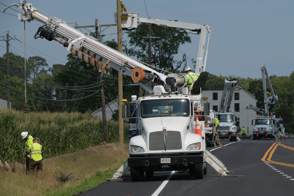
The National Weather Service said Thursday that a tornado associated with Tropical Storm Isaias touched down in Dover Tuesday and spun its way along a 29-mile path, carrying its destructive force to Middletown. The EF-1 tornado was estimated to last from 8:55 a.m. until 9:25 a.m. It packed a maximum estimated wind speed of 105…
Read MoreHeat Advisory Until 7pm Monday for Inland Sussex County

The Excessive Heat Warning has expired – the National Weather Service has issued a Heat Advisory from 10pm Sunday until 7pm Monday for inland Sussex County. Heat index values…up to 114 due to temperatures in the upper 90s, and dewpoints in the mid 70s on Sunday. By Monday, heat index values of 100 to 107…
Read More